Topo Survey in Hertfordshire
High-Precision Topographic Surveys Delivering Reliable Site Data for Construction & Design
Get a Free Quote From Us Today!
We aim to get back to you in 24 hours.
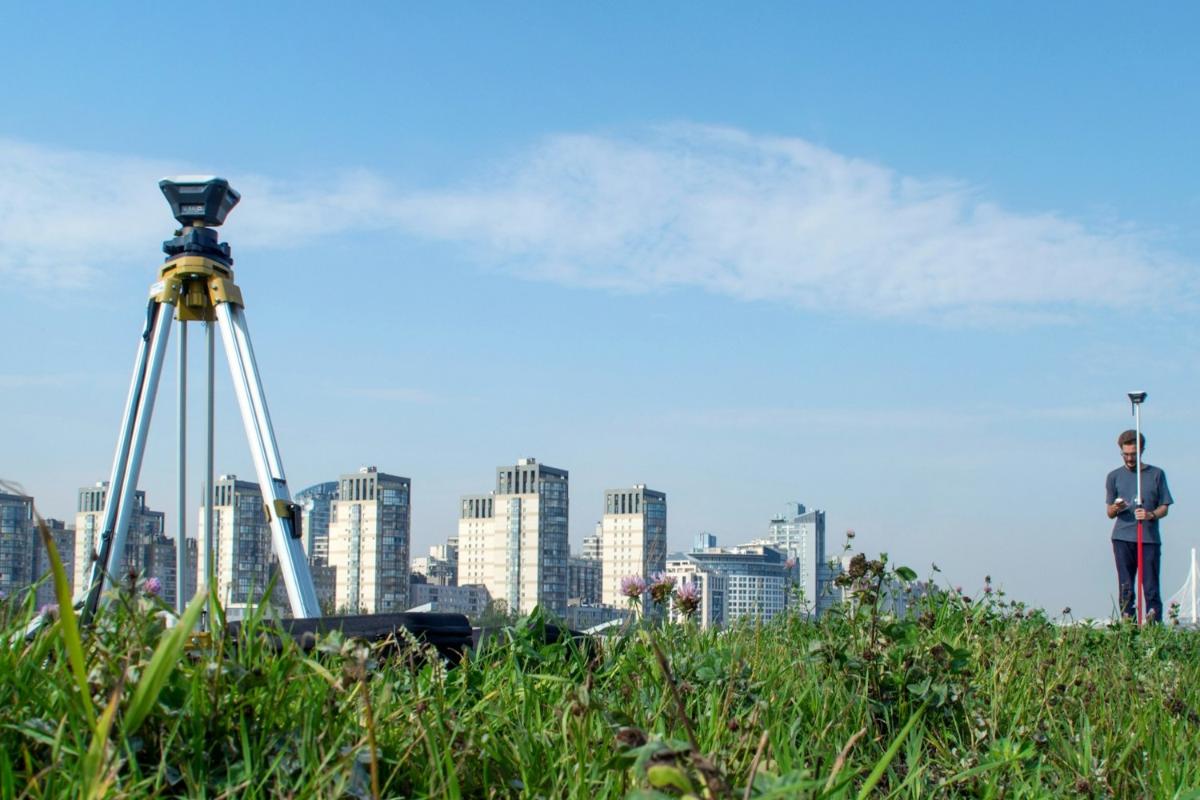
At Topo Survey, we provide precise land measurement and mapping services designed to support planning, design, and construction projects in Hertfordshire AL and across the UK. Our service focuses on capturing accurate information about terrain, levels, and site features to enable informed decision-making for architects and engineers.
By utilising precision instrumentation, topo survey ensures reliable, high-quality data for projects of all sizes, allowing your team to proceed with absolute confidence in the geospatial foundation.
How Much Does a Topo Survey Cost in Hertfordshire?
The cost of a topo survey in Hertfordshire ranges from £450 to over £4,000, depending on the site size, the density of vegetation, and the level of detail required for the final plans.
Costs are primarily influenced by the time required on-site for data capture and the complexity of the post-processing phase needed to produce CAD or Revit outputs.
Contact Topo Survey to get customised prices for getting a topo survey at your property.
Get a Free No Obligation Quotation Today
What Services Are Included in a Topo Survey in Hertfordshire?
The services included in a topo survey in Hertfordshire comprise site measurement, level recording, feature mapping, boundary identification, data capture, processing, and production of CAD drawings or 3D models.
We deliver a comprehensive data package that includes precise site measurements of buildings and manholes alongside detailed level recordings. Additional technical consultancy is provided to help clients interpret complex data, ensuring that the survey satisfies the specific requirements of structural engineers.
Where is a Topo Survey Required Across Projects in Hertfordshire?
A topo survey in Hertfordshire is required for construction projects, residential and commercial developments, infrastructure works, land planning, and engineering design. The service is critical for both greenfield sites and urban regeneration projects where accurate geospatial data is non-negotiable.
By mapping the site environment, the survey ensures that foundation designs and piling are based on the actual height of the ground, preventing delays during excavation and ensuring structural safety.
When Should You Carry Out a Topo Survey in Hertfordshire?
You should carry out a topo survey in Hertfordshire at the early planning and design stage of a project, before construction begins. Engaging a surveying team during feasibility studies helps identify potential site constraints like protected trees or steep slopes.
This early insight ensures that the planning application is supported by verifiable data, which helps avoid local authority objections and costly structural redesigns later in the project lifecycle.
How Does the Topo Survey Process Work?
The topo survey involves site assessment, data capture using surveying instruments such as total stations, GPS, or laser scanners, processing of measurements, and production of detailed plans or models.
Geomatic engineers perform a systematic walkthrough to record coordinates with millimetre precision. This raw data is then triangulated and layered within CAD software, resulting in a structured technical drawing that serves as the legal and engineering foundation for all subsequent construction activities.
What Data, Levels, and Site Features Are Captured in a Topo Survey?
A topo survey ensures comprehensive data capture by recording every critical element of the physical landscape:
- Natural Vegetation – Documenting the location and canopy spread of trees and bushes for environmental and planning compliance.
- Ground Levels and Contours – Recording elevation data across the site to facilitate accurate drainage and earthwork volume calculations.
- Buildings and Structures – Mapping the footprints and heights of existing buildings, walls, and other permanent features.
- Boundaries and Fences – Establishing the precise limits of the property to prevent encroachment and define legal divisions.
- Surface Features and Utilities – Identifying visible manhole covers, services, and site elements that impact subterranean infrastructure design.
Request a free quote
Which Industries and Projects Require Topo Surveys?
The industries and projects that require a topo survey include architects, engineers, developers, construction companies, local authorities, and landowners. Civil engineers need precise data for bridge and highway design, while utility providers use the maps for new connections.
For landowners and legal professionals, the survey provides a definitive record of features, which is crucial for resolving boundary disputes or land registration.
How Quickly Can a Topo Survey Be Completed in Hertfordshire?
A topo survey in Hertfordshire can typically be completed within one to several days, depending on site size, complexity, and level of detail required. Once the field work is finished, the raw coordinates are subjected to computational processing.
This efficient turnaround provides high-quality digital deliverables ready for immediate use, ensuring that the design phase proceeds without unnecessary delays or interruptions to the project timeline.
What Accuracy Standards and Regulations Apply to Topo Surveys in Hertfordshire?
A topo survey in Hertfordshire follows recognised UK standards such as RICS guidelines and project-specific accuracy requirements. Adhering to the RICS Professional Statement ensures that geospatial data is legally defensible and technically consistent.
These regulations dictate horizontal and vertical tolerances, providing the insurance-backed certainty required for large-scale infrastructure or commercial building works across the United Kingdom.
Why Should You Choose Professional Topo Survey Services in Hertfordshire?
Choosing a professional topo survey provides expert measurement, accurate data, and dependable outputs that support safe and efficient project development. Utilising advanced laser technology ensures a level of precision that unvetted providers cannot match.
This professional oversight minimises mapping errors, ensuring that your structural designs are feasible and that the development is compliant with both safety and legal standards.
Contact Topo Survey in Hertfordshire for a consultation to get topo survey tailored to your organisation’s risks and responsibilities.
speak with our team today
What People are Saying About Us
★★★★★
"The team at Topo Survey delivered detailed mapping data that made our planning stage far more efficient. Communication was excellent throughout, and the turnaround time exceeded expectations. Their accuracy and professionalism gave us complete confidence in the project."
Kyra Henshaw
East of England
★★★★★
"We used Topo Survey for a commercial site development and were impressed by how organised and thorough the process was from start to finish. The survey reports were clear, reliable, and extremely helpful for our architects. A dependable company with a knowledgeable team."
Georgia Talbot
East of England
★★★★★
"Topo Survey provided accurate land measurements that helped us avoid delays during construction planning. The staff were approachable, punctual, and genuinely committed to quality work. Everything was handled with a high level of care and attention."
Jamie Colquhoun
East of England
★★★★★
"Very pleased with the service we received from Topo Survey. The digital survey data was delivered promptly and integrated seamlessly into our design workflow. It made the entire process smoother and far more cost-effective for our team."
Edith Norris
East of England
Our Locations
Looking for our services in another area in Hertfordshire? We are proud to work nationally across the UK, allowing us to ensure we can provide our specialist Topo Survey services to you.
For a full list of locations we cover in Hertfordshire, see below.